


Flagstaff Road is a steep mountain road with hairpin turns. In winter, ensure you have snow tires or chains and check that conditions are driveable. And if you need to take a moment to enjoy the scenery or consult your map, pull over in a safe, out-of-the-way spot, such as Panorama Point or Crown Rock Trailhead.
Realization Point Trail Map
View the City of Boulder's trail map for hikes in the Realization Point area.
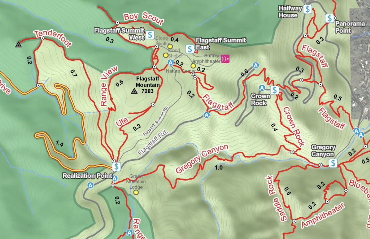
Need to use the restroom on the way up? Stop at the Halfway House just past Panorama Point and follow the signs for "latrines," 150 yards south of the stone shelter. Or find more restrooms at the Flagstaff Summit.
Chapman Drive Trail
Dogs allowed: Yes, leashed
Trail Map
Where to Park
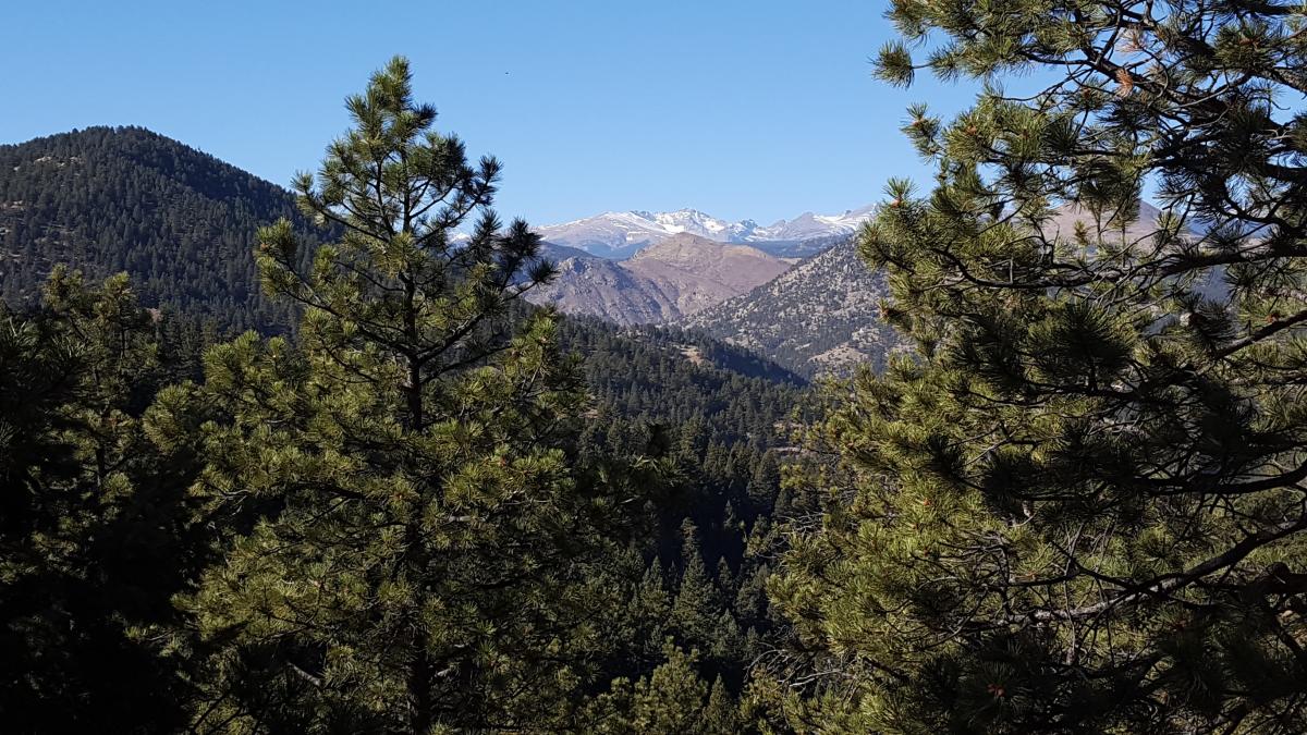
Chapman Drive is a wide dirt road (shared by mountain bikers) that gazes down at a canyon, thick with ponderosa pines, and beyond to the snow-capped Indian Peaks looking west. This is an out-and-back trail that starts on the downhill from Realization Point, so save some energy for the climb back up. It’s wide and level, but the steady incline will give your calves a good workout.
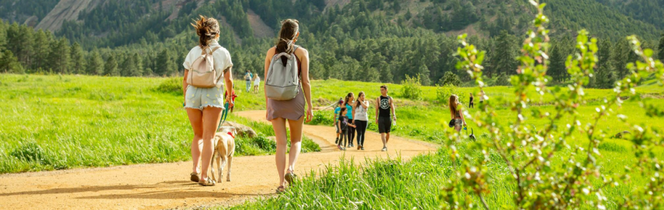
Yield to people going uphill. That’s the etiquette for hikers in Boulder, the thought being it takes more energy to go uphill than down.
Straying from the designated paths can cause harmful erosion or irreversible damage to vegetation and lower soil quality. So we ask you to take the road most traveled (much to Robert Frost's dismay).
Ranger Trail
Dogs allowed: Yes, leashed
Trail Map
Where to Park
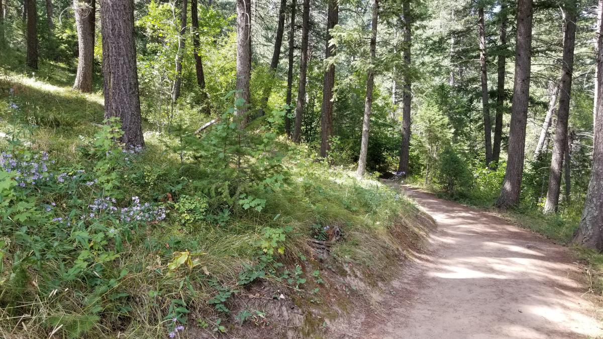
With tall pines above and rust-red earth beneath your feet, this fragrant trail is easy to get to but feels like you’ve escaped deep into the woods. After only about five minutes of hiking, you’ll come upon a clearing just before you reach the historic Green Mountain Lodge. Here dozens of butterflies drink the nectar of wild bergamot in summer, and a pair of picnic tables await for resting. Continue on and you’ll head back into the cool forest before the trail gets quite steep (after about a half mile) and dramatic views rise behind you. Eventually, you can intersect with Green Mountain West Ridge Trail, which leads you to summit Green Mountain — no small feat, to be sure.
Before you head out, you can check real-time parking and weather conditions at various area trailheads, including Panorama Point and Flagstaff Nature Center, thanks to Open Space and Mountain Parks' handy trailhead cameras!
Boy Scout Trail
Dogs allowed: No
Trail Map
Where to Park
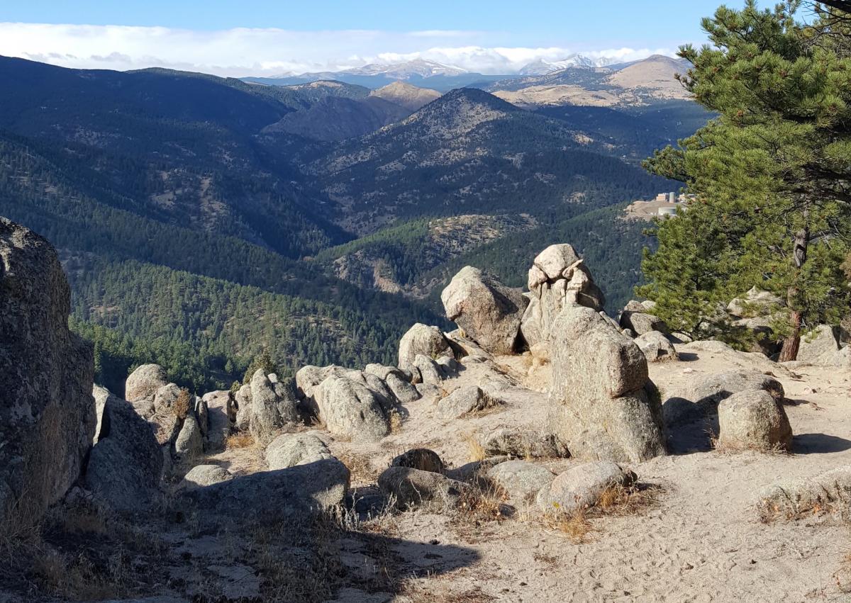
This family-friendly hike has forest-framed views and boulder-strewn terrain ending in a breathtaking lookout at May’s Point. It becomes a fantastic kingdom of rock castles and trees for kids to scramble over, climb on and hide behind.
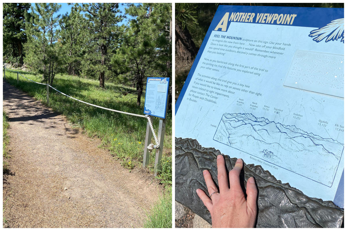
Sensory Trail
Dogs allowed: Yes, leashed
Trail Map
Where to Park
The Sensory Trail is a special trail designed to help you explore nature using senses other than sight. A rope railing guides you along at the beginning of the trail. You'll be prompted by signage to blindfold yourself, if you are a sighted visitor, and have a family member or friend be your guide as you explore the rest of the trail together.
Twelve interpretative signs (with printed words and braille) will instruct you to discover your senses through exercises such as feeling the difference between two types of rock in your hands, comparing the scent and feel of various tree species, and "seeing" a mountain panorama with your fingertips on a relief model of the mountains. You'll be amazed at what you hear, smell and feel in this lively natural environment without sight.
Get rid of litter even when it isn’t yours! Trashy areas make for poor pictures and an unhealthy ecosystem. Remember, food trash is litter too. Pack out your fruit peels and eggshells (and don't give the chipmunks a stomachache).
Flagstaff Nature Center
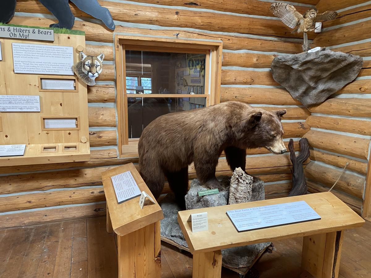
Open in summer, the Flagstaff Nature Center is a fantastic mountain-top stop for families. Learn what creatures and plants live in the forest and grasslands all around you, play games and discover interactive nature-themed activities. There's a model version of Boulder's mountains, a historical timeline, rocks you can handle as you learn about the area's geology, real animal displays you can get up close to and animal bones you can touch. The center is open from about 10:30am-4 pm on Fridays, Saturdays and Sundays, June through September when volunteers are available (there are a few occasions when the center closes during these times since it is staffed only by volunteers).
More Ideas for You

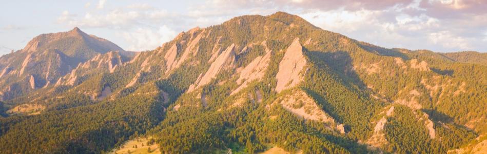
Chautauqua Hikes
A guide to Boulder's most famous hiking area

Boulder's Best Pools
Refresh at the foot of the mountains.

The Boulder Foodie Checklist
The top dining spots you must hit