


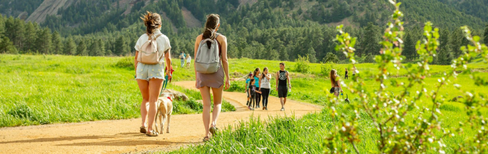

Help protect Boulder's natural beauty by remembering these Leave No Trace principles, and before you go, check here for trail closures due to trail conditions.
1. Wonderland Lake Loop Trail
Difficulty: Easy
Distance: 1.5 mile
Dogs allowed: Yes, but see regulations
Trail Map
Where to Park (No Fee)
This pretty little lake is nestled among neighborhoods and parkland in the foothills of North Boulder. As you start on the flat, pleasant, looping trail, you’ll enjoy the distant Flatirons reflected in the water. Keep an eye out for paragliders, who use the top of the Wonderland Hill Trail as a launch point.
Get muddy! Remember to stay on trail, even when it’s muddy. Stepping off trail creates erosion and widens the trail into natural habitat.
2. Flatirons Vista
Photo: Jeremiah LaRocco/Flickr Creative Commons
Difficulty: Easy
Distance: 3.5 miles
Dogs allowed: Yes, but see regulations
Trail Map
Where to Park (Fee)
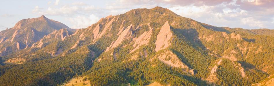
While the most iconic views of the Flatirons are from the Chautauqua Trailhead, this trail south of town stands at a distance to the iconic formations, giving you unparalleled views of the whole mountain range. Equally great for trail runners and families, the open landscape of this trail (bring plenty of sunscreen) gives you a sense of scale and geography you won’t get on trails that lead directly into the foothills. Plus, for those who want a longer trek, plenty of connecting trails make it possible.
3. Chapman Drive and Tenderfoot Trail
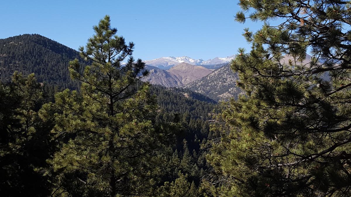
Difficulty: Moderate
Distance: 2.5 miles
Dogs allowed: Yes, but see regulations
Trail Map
Where to Park (Fee)
The drive alone, up Flagstaff Mountain to Realization Point, is a great way to take in views of the University of Colorado’s red-tile rooftops and all of Boulder below. Once on the trail, start down Chapman Drive, a wide, dirt road (shared by mountain bikers) and gaze down at a canyon thick with ponderosa pine forest and beyond to the snow-capped Indian Peaks to the west. A mile and a half in, turn right onto Tenderfoot Trail, which winds through a flowering meadow. Follow the signs for the overlook spur trail for postcard-perfect views of some of Colorado’s tallest peaks.
4. Rattlesnake Gulch
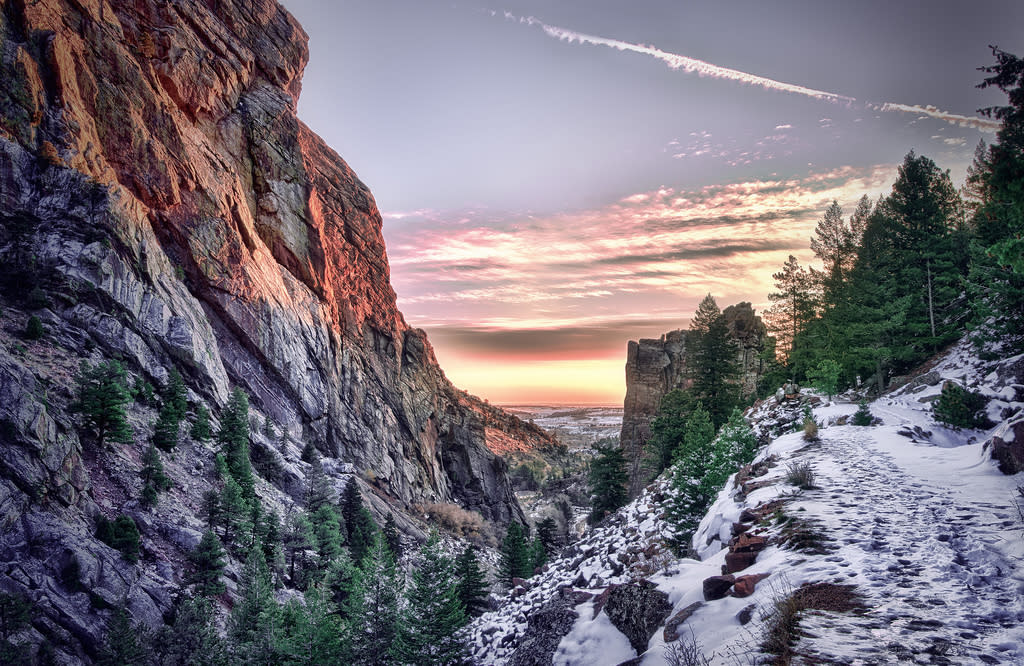
Photo: Flickr Creative Commons/Max and Dee Bernt
Difficulty: Moderate
Distance: 3.6 miles
Dogs allowed: Yes, leashed
Trail Map
Where to Park (Park Fees to Enter) or Ride the Shuttle
Important: Timed-entry reservations are required in Eldorado Canyon State Park on weekends and holidays from May 1-October 1. Alternatively, you can take the Eldo Shuttle for guaranteed entrance to the park.
The dramatic, striated walls of Eldorado Canyon State Park are just 20 minutes south of Boulder, and its full of hiking, biking, and outdoor recreation opportunities. Rattlesnake Gulch is a moderate hiking option that will take you past spectacular views of the canyon and Colorado’s eastern plains in the distance. You’ll also pass the remnants of the historic Crags Hotel, which was built in 1908 but burned down in 1913. Continue on to the Continental Divide Overlook, and have your camera ready!
Always pack out your dog’s poop and dispose of it properly. Besides its bad smell, dog waste can pollute water sources and encourage noxious weeds to grow.
7. Red Rocks Trail
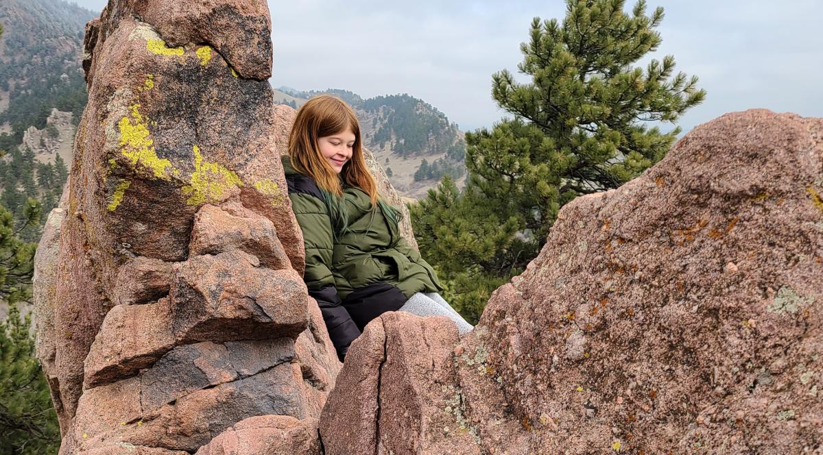 Difficulty: Easy to Moderate
Distance: 0.7 miles
Dogs allowed: Yes, but see regulations
Trail Map
Where to Park (Free)
About a five-minute walk from downtown Boulder is the trailhead at The Peoples' Crossing. Here, the relatively gentle, short Red Rocks Trail winds up into otherworldly, ochre-colored sandstone outcroppings that mimic those of its much more famous cousin: the legendary Red Rocks Amphitheatre in Morrison, Colorado. While there’s no live music in Boulder’s Red Rocks (unless you bring your own instrument!), the views are superb and it’s an excellent spot to drape yourself over a sun-warmed boulder or enjoy a picnic. These are perfect scrambling rocks for kids.
Yield to people going uphill. That’s the etiquette for hikers in Boulder, the thought being it takes more energy to go uphill than down.
Bring food and water for longer hikes. The slightly higher altitude means you may get dehydrated more easily. And don't forget to bring water for your dogs!
More Ideas for You

Accessible Trails
Trail recommendations for hikers with disabilities

4 Spectacular Wilderness Escapes
Close to Boulder, far from ordinary

Boulder Coffee Crawl
Every indie coffee shop in Boulder, on a single map